Pilot-project further develops Tyrolean cycle route network

One of our newest Cycle Competence members, max2 from Tyrol are specialists in route-mapping and signage. They are using this expertise to expand the Tyrollean cycle orientation signage in a new project in the area surrounding Hall in Tyrol. The demands on signage systems should always reflect the needs of the cyclists who use them, be they signposts, road markings, info points or other infrastructure and must reflect certain quality standards such as consistency, legibility and visibility.
In order to achieve this, certain standardised elements are used such as ‘Tern Pictograms’ and also a carefully orchestrated set of planning steps. Alongside codified content standards, the planning data also has to be included in a geo-information system (GIS) as well as in a graphic integration platform (GIP) in order to create accurate interactive maps and allow for the administration and management of signage.
Additions to the Tyrollean cycle network handbook
The agency max2 has created comprehensive route signage in the municipalities of Absam, Hall, Mils, Rum and Thaur. This project also served as a pilot project to demonstrate the extension of such signage into urban areas. The specialists at max2 are currently updating the tyrollean cycle network handbook to include this new signage in order to provide planners with new, even more extensive planning guidelines for the future.
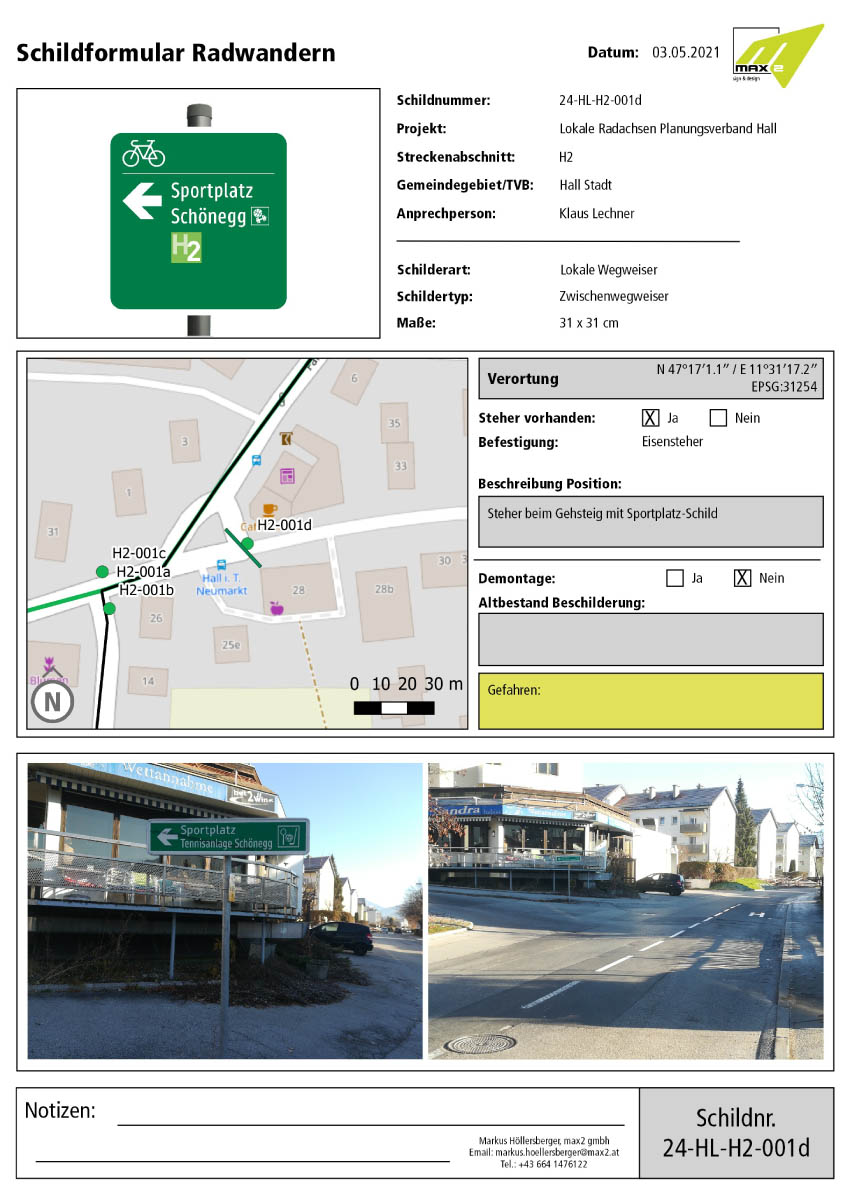
The project has made 60 kilometres of cycle routes visible and well signposted. Whilst developing the routes further, special attention was payed to making local routes clear and easy to navigate for cyclists. One example of this is making axial routes more accessible. Instructions on how to reach them are included on signs preceding the main route, as seen in the picture below. Furthermore, the signs follow the new RVS-guidelines which we have already reported on here: read article
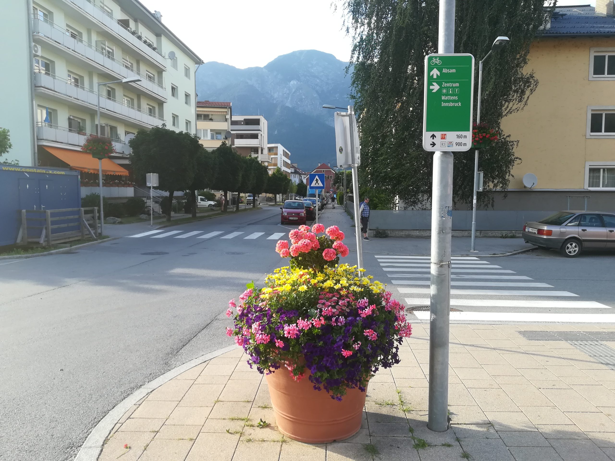
Example of local signage
Reduction of confusing sign-jungle with new guidance system
The tyrollean cycle route guidance system now represents a comprehensive signage system which communicates both long distance and local cycle routes to cyclists in the area. This makes navigation and orientation much easier for cyclists who use the network. The system can even be expanded in the future to include things like Mountainbike routes and on-road routes which eventually lead off road, all clearly visible on one standardised sign.
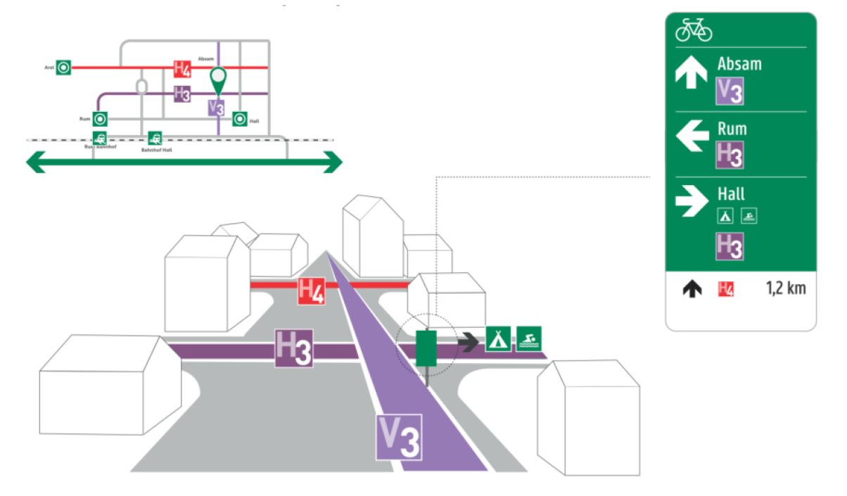
Main sign at a junction displaying both regional and local routes
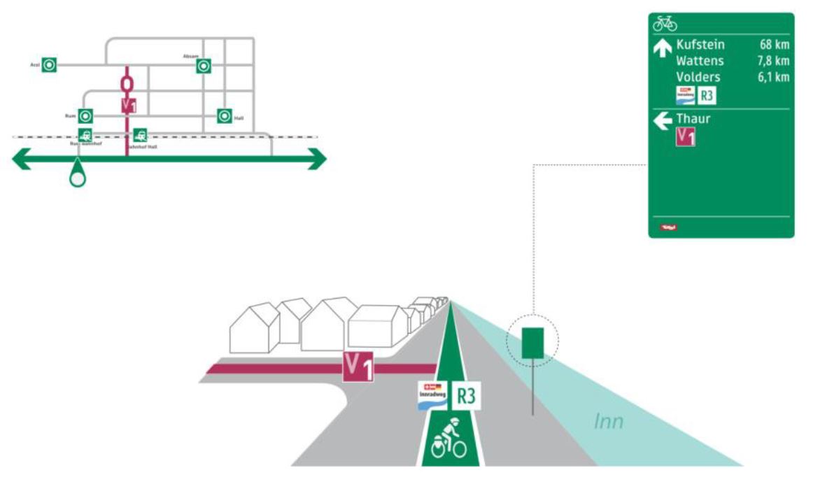
Intermediate sign displaying advance information of an approaching major route
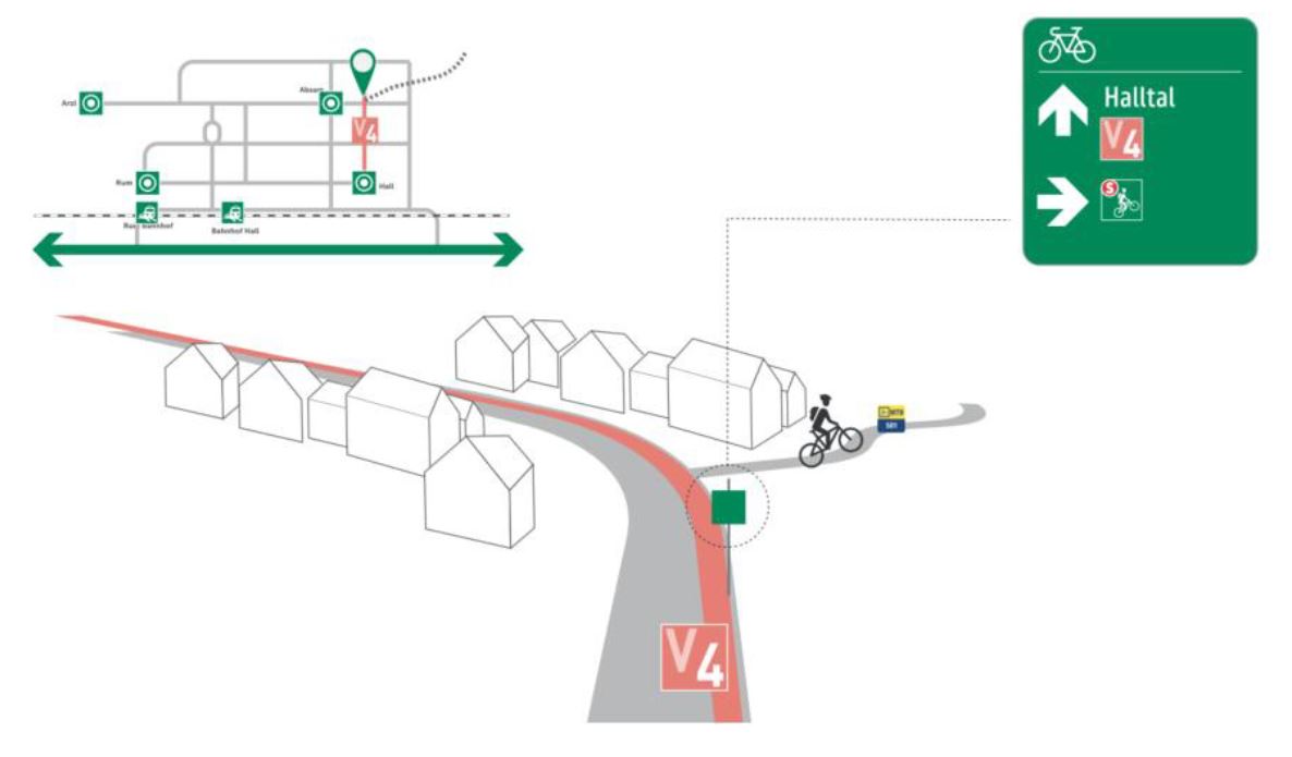
Intermediate sign displaying the start of a mountainbike route
Detailed mounting instructions for signs
A further improvement is the detailed instruction sheet included with each sign, making it clear to installation teams exactly how and where each sign should be mounted. The instructions are so detailed that later maintenance and evaluation works are made very uncomplicated and easy to manage.
Cycling Competence Members in this article:
More articles with this member:
Share this article:
Pilot-project further develops Tyrolean cycle route network
Share this article:
One of our newest Cycle Competence members, max2 from Tyrol are specialists in route-mapping and signage. They are using this expertise to expand the Tyrollean cycle orientation signage in a new project in the area surrounding Hall in Tyrol. The demands on signage systems should always reflect the needs of the cyclists who use them, be they signposts, road markings, info points or other infrastructure and must reflect certain quality standards such as consistency, legibility and visibility.
In order to achieve this, certain standardised elements are used such as ‘Tern Pictograms’ and also a carefully orchestrated set of planning steps. Alongside codified content standards, the planning data also has to be included in a geo-information system (GIS) as well as in a graphic integration platform (GIP) in order to create accurate interactive maps and allow for the administration and management of signage.
Additions to the Tyrollean cycle network handbook
The agency max2 has created comprehensive route signage in the municipalities of Absam, Hall, Mils, Rum and Thaur. This project also served as a pilot project to demonstrate the extension of such signage into urban areas. The specialists at max2 are currently updating the tyrollean cycle network handbook to include this new signage in order to provide planners with new, even more extensive planning guidelines for the future.
The project has made 60 kilometres of cycle routes visible and well signposted. Whilst developing the routes further, special attention was payed to making local routes clear and easy to navigate for cyclists. One example of this is making axial routes more accessible. Instructions on how to reach them are included on signs preceding the main route, as seen in the picture below. Furthermore, the signs follow the new RVS-guidelines which we have already reported on here: read article
Example of local signage
Reduction of confusing sign-jungle with new guidance system
The tyrollean cycle route guidance system now represents a comprehensive signage system which communicates both long distance and local cycle routes to cyclists in the area. This makes navigation and orientation much easier for cyclists who use the network. The system can even be expanded in the future to include things like Mountainbike routes and on-road routes which eventually lead off road, all clearly visible on one standardised sign.
Main sign at a junction displaying both regional and local routes
Intermediate sign displaying advance information of an approaching major route
Intermediate sign displaying the start of a mountainbike route
Detailed mounting instructions for signs
A further improvement is the detailed instruction sheet included with each sign, making it clear to installation teams exactly how and where each sign should be mounted. The instructions are so detailed that later maintenance and evaluation works are made very uncomplicated and easy to manage.